[Study] The Deadliest Road Stretches in Arizona

Recent Blog Posts

How to win a car accident case.
By marketing sargon July 15, 2026
Learn what it takes to win a car accident case, from proving fault to calculating damages, so you know what to expect after a crash.
What is a summary judgment?
By marketing sargon July 10, 2026
Learn what a summary judgment is, how it affects personal injury cases and what can happen after a judge rules on this pretrial motion.
In a partial fault car accident?
By Michael Morgan July 10, 2026
Learn how a partial fault car accident can affect your compensation in Arizona, California and Colorado, including insurance claims and fault disputes.
How Do Pre-Existing Conditions Affect a Personal Injury Case?
By marketing sargon July 7, 2026
Find out how pre-existing conditions can affect a personal injury case and what steps you can take to protect your claim.
Can you sue for emotional distress?
By Michael Morgan July 6, 2026
Can you sue for emotional distress? Learn when you can file a civil suit for emotional distress, what evidence can prove harm and how filing deadlines may vary by state.

[Study] The Deadliest Road Stretches in Arizona

In Arizona, hundreds of people are killed in motor vehicle collisions every year. In fact, over the last 20 years, the state averaged nearly 1,000 annual traffic fatalities. Where are the most dangerous places on Arizona roads? Are there areas where motorists are killed at higher rates? We examined 20 years of fatal crash data from the NHTSA to find out what stretches of highway in Arizona are the deadliest. Based on this data found, we identified the ten most deadliest five-mile stretches of road in the state, based on fatal collision volume.


At Sargon Law Group, our Phoenix car accident attorneys understand the devastating impact a fatal car accident can take on victims and their families. This motivated us to identify the deadliest stretches of highway in Arizona, to provide drivers with helpful information to stay safe on the road.


We worked with data visualization agency 1Point21 Interactive to analyze fatal car crash data from the NHTSA to identify the highway segments with the most fatal crashes and deaths. Below we will look at the top 10 deadliest stretches and a breakdown of the top five with images.


Interactive Map: Arizona's Deadliest Roads

The map below is interactive. Pinch or use the mouse wheel to zoom in and hover over each stretch to reveal more information.

The top five (and nine of the top ten) deadliest road segments were found in the Phoenix metro area, four of which were within the city limits of Phoenix. Four of the top 5 sections include at least one freeway interchange along them. Freeway interchanges by nature are dangerous because of merging, which increases the chances for accidents to occur and also lead to an increased traffic volume.


In this section, we provide a bit more context surrounding each of the top 5 deadliest road segments.


Table: The Ten Deadliest Road Segments in Arizona

Below is detailed info for each segment that we identified. Rank was determined by fatal collision volume, with ties being broken by total deaths.

Rank Road City Crashes Deaths
1 AZ-101 Tempe 41 44
2 I-10 Phoenix 39 47
3 I-10 Phoenix 39 42
4 I-17 Phoenix 36 44
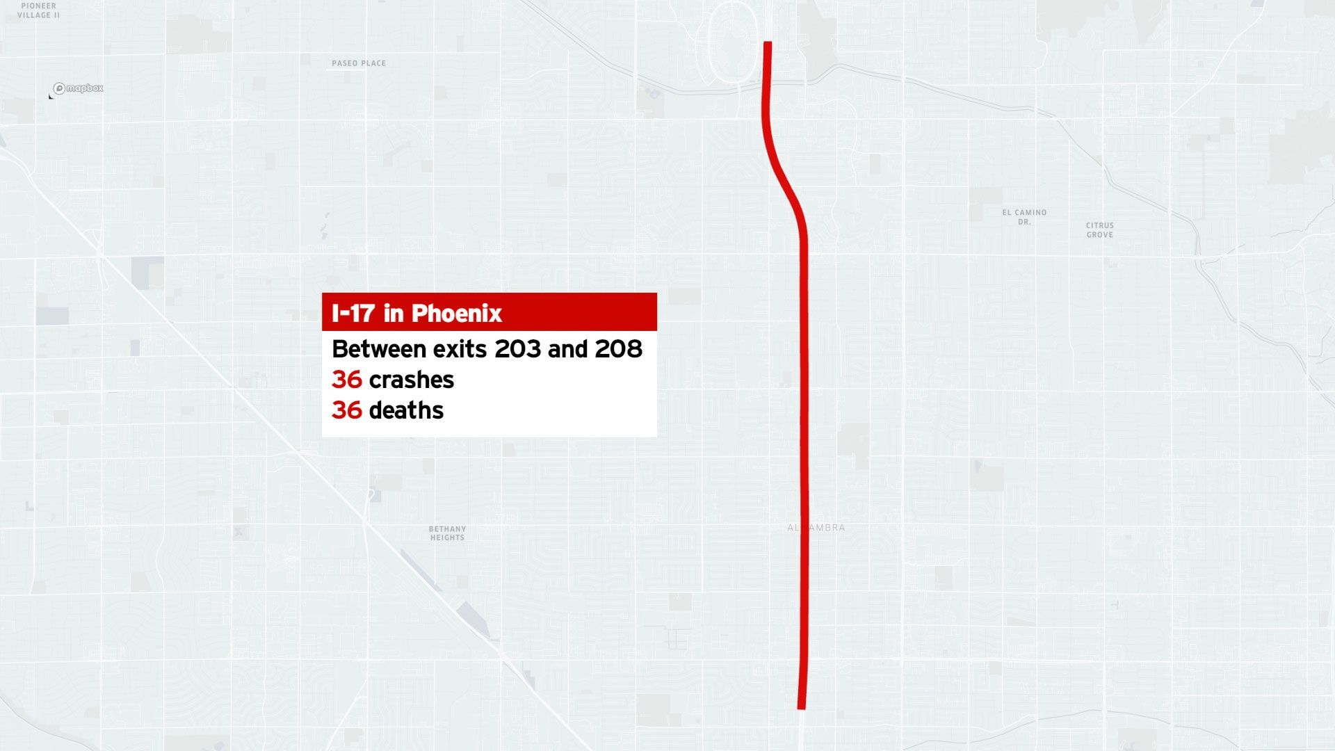
5 I-17 Phoenix 36 36
6 AZ-101 Phoenix 33 35
7 I-17 Phoenix 28 30
8 US-60 Mesa 27 27
9 AZ-101 Peoria 25 28
10 I-10 Tuscon 21 22

A Closer Look at the Top Five

The top five (and nine of the top ten) were found in the Phoenix metro area, four of which were within the city limits of Phoenix. In this section, we provide a bit more context surrounding each.

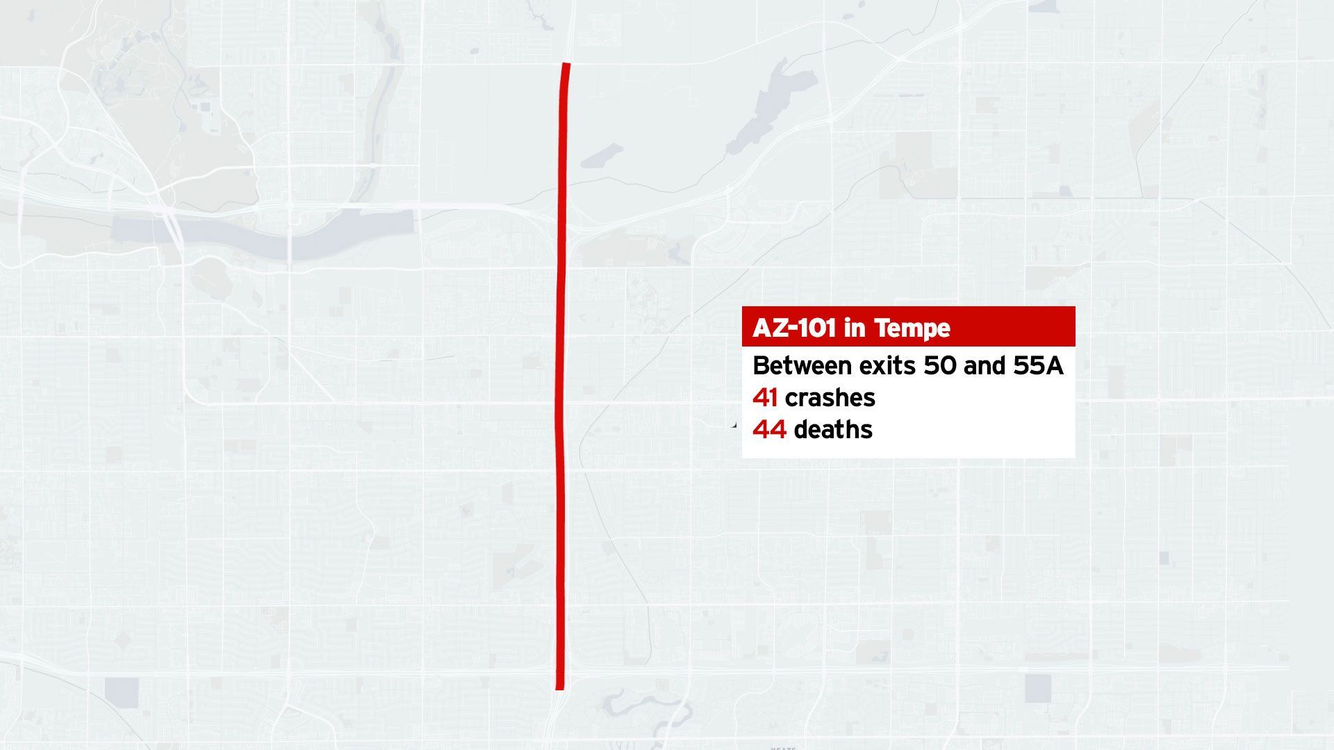
A map showing a red line on AZ-101 in Tempe, with a text box reporting 41 crashes and 44 deaths between exits 50 and 55A.

Number 1: AZ - 101

City: Tempe

Fatal Crashes: 41

Fatalities: 44


The deadliest 5-mile stretch of highway in Arizona is between exits 50 & 55A on AZ-101 with a total of 41 crashes and 44 deaths. Located just off exit 50 is Casino Arizona and on the other end at exit 55A are shopping centers, several schools, a community college, a golf course, and a large neighborhood. Additionally, there is an interchange found along this path between AZ-202 and AZ-101.

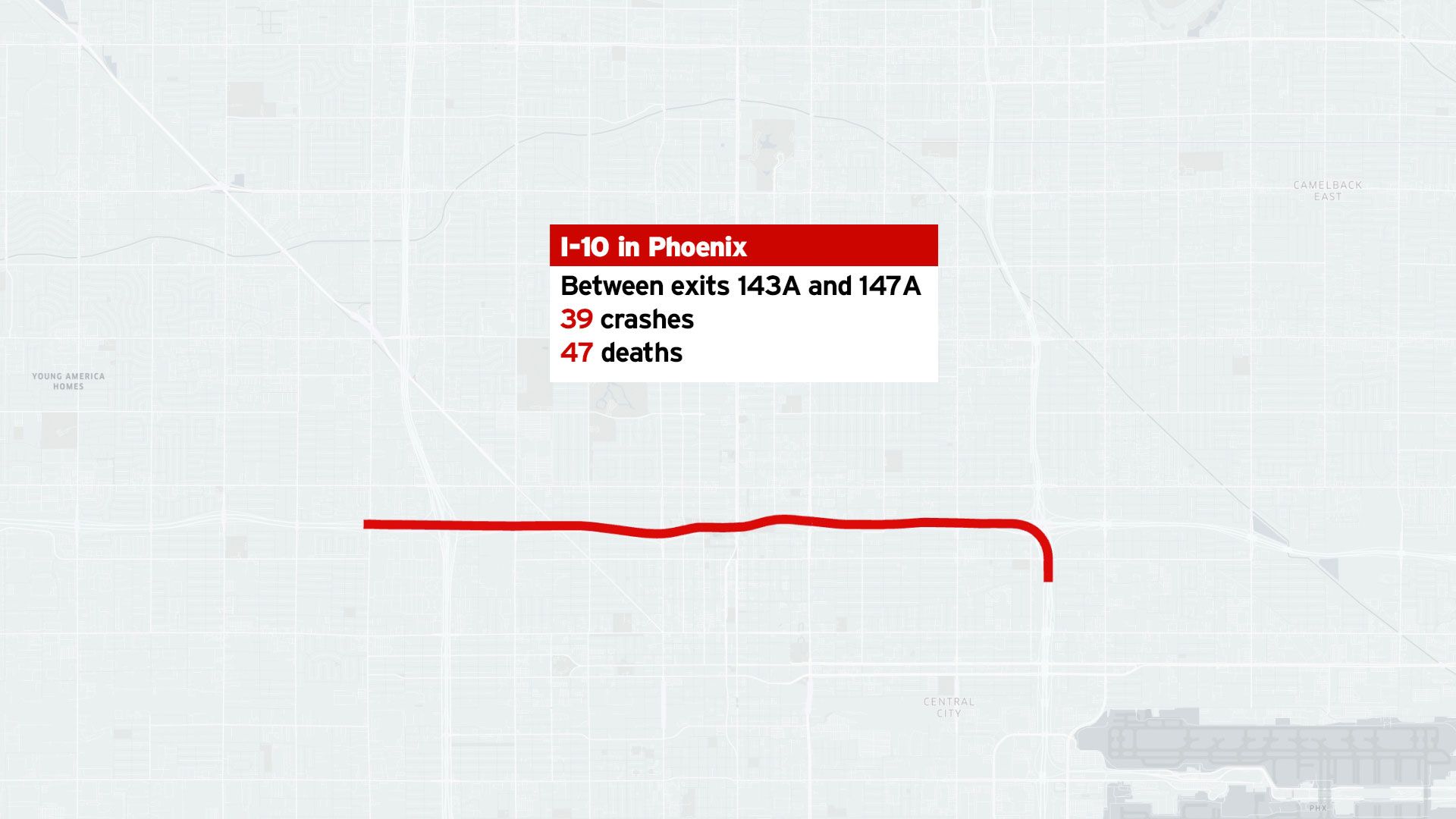
Map showing I-10 in Phoenix between exits 143A and 147A, with a label reporting 39 crashes and 47 deaths.

Number 2: I-10

City: Phoenix

Fatal Crashes: 39

Fatalities: 47


The second deadliest 5 mile stretch of highway in Arizona can be found on I-10, between exits 143A & 147A. In this section of highway, there have been 39 crashes, and 47 deaths. This stretch is found in the heart of Phoenix and within it there are two major interchanges. One between I-10 and I-17 and another between AZ-202, AZ-51 and I-10. On the exit 143A end of this section Valleywise Health Medical Center Hospital can be found. At the exit 147A end, there are several schools and shopping centers. Because of the dense population in Phoenix coupled with two highly trafficked areas on either side of this deadly stretch of highway, traffic can be heavy, and thus increases the likelyhood of accidents.

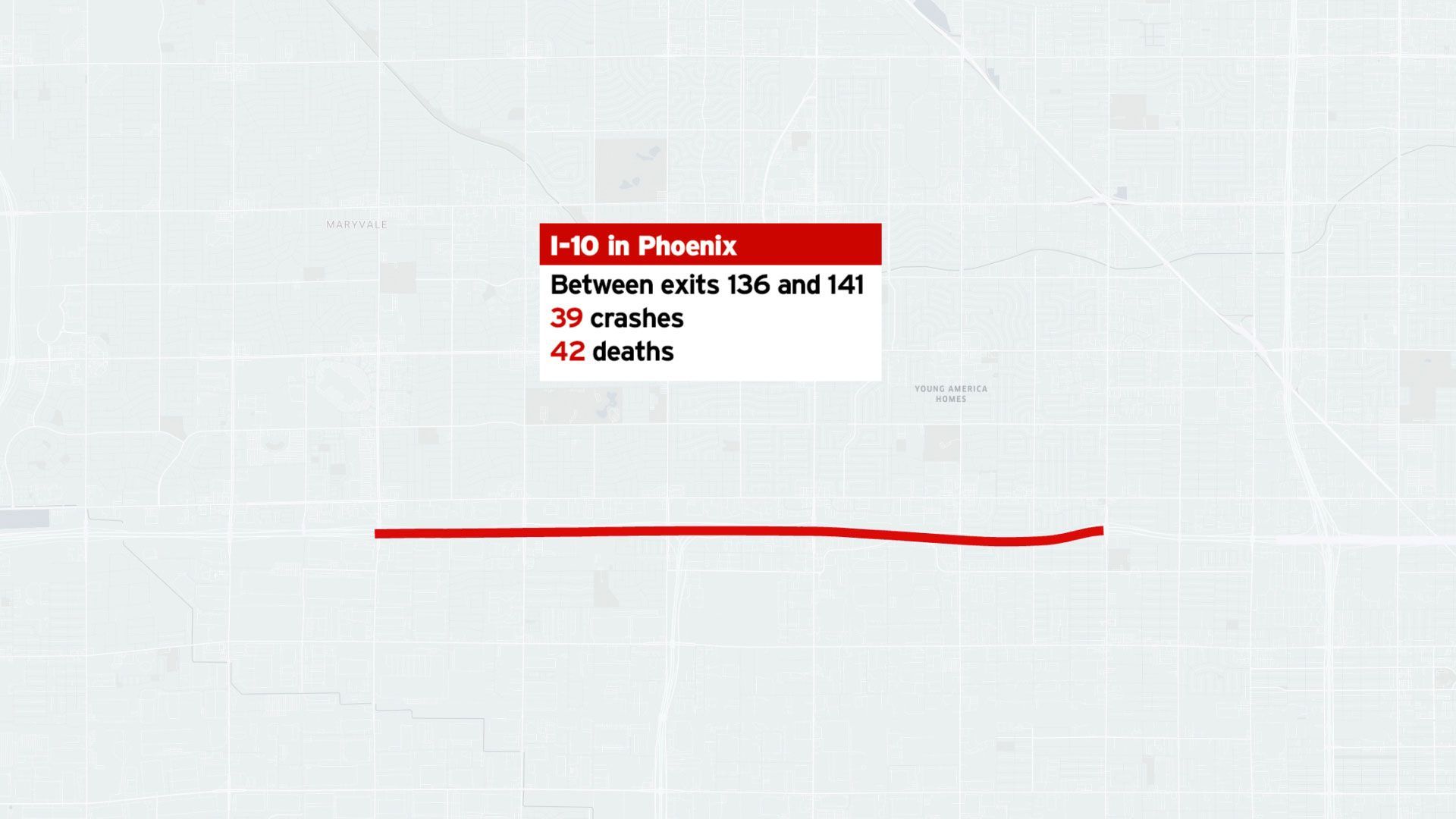
Map of I-10 in Phoenix showing 39 crashes and 42 deaths between exits 135 and 141.

Number 3: I-10

City: Phoenix

Fatal Crashes: 39

Fatalities: 42


The third deadliest highway stretch in Arizona with 39 crashes and 42 deaths can be found between exits 136 & 141 on I-10. On the exit 136 end of this stretch, there are several large stores, a mall, and an Amazon shipping center. On the exit 141 end are several schools and a large residential area. Additionally, there is an interchange between I-10 and AZ-202 along this stretch that can cause an increase in traffic flow.

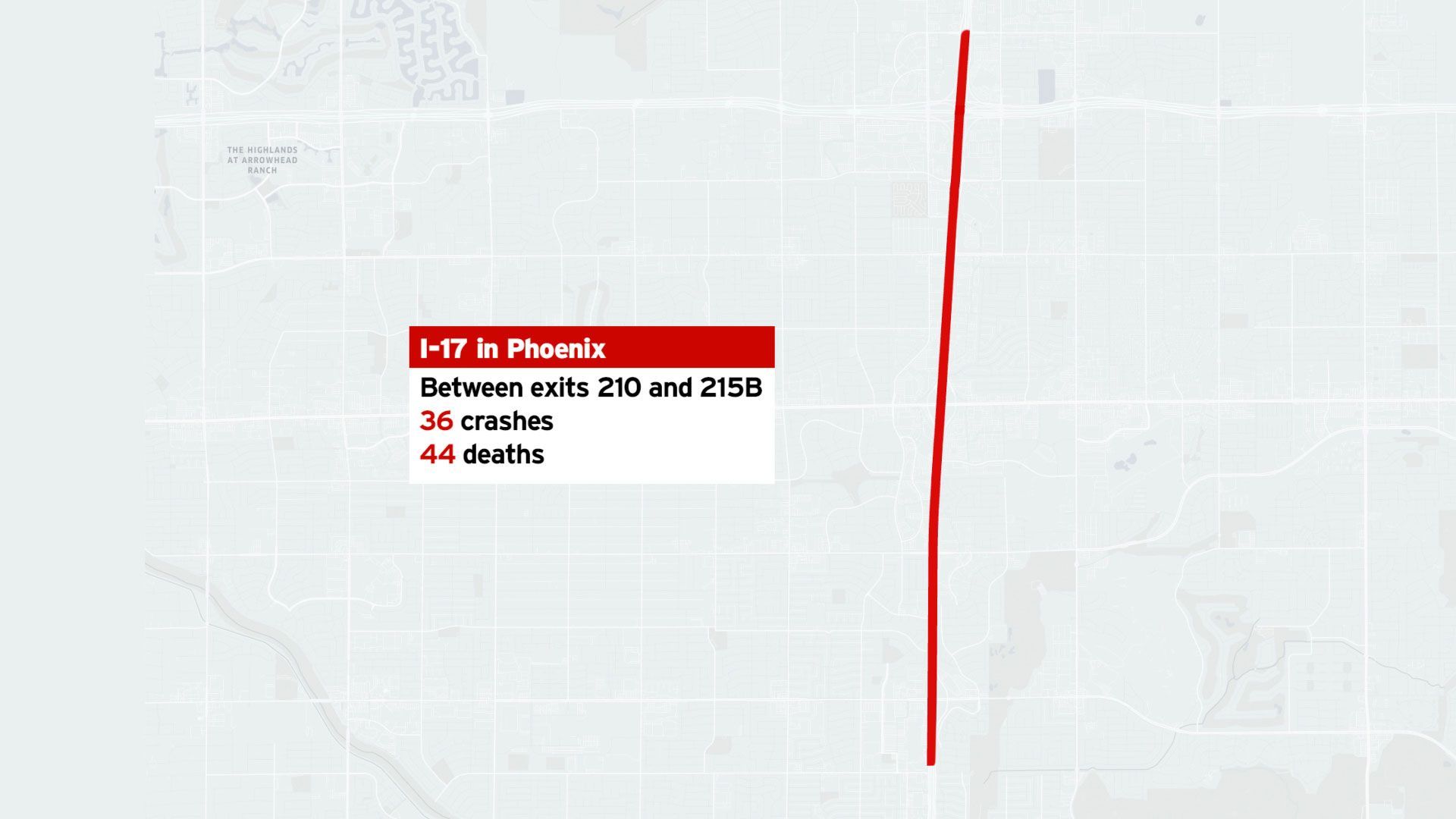
Map shows I-17 in Phoenix between exits 210 and 215, noting 36 crashes and 44 deaths in red text.

Number 4: I-17

City: Phoenix

Fatal Crashes: 36

Fatalities: 44


The fourth deadliest stretch of highway in Arizona can be found between exits 210 and 215B on I-17. Throughout this stretch 36 crashes have occurred, resulting in 44 deaths. This section of highway has an interchange with AZ-101, which increases traffic. On either end of this section are heavily trafficked areas, on the exit 210 side ASU West Campus, a shopping center and several churches can be found. On the exit 215B side are several schools and a large residential area.

A map showing a stretch of I-17 in Phoenix between exits 200 and 208, labeled with 38 crashes and 38 deaths.

Number 5: I-17

City: Phoenix

Fatal Crashes: 36

Fatalities: 36


The fifth deadliest stretch of highway in Arizona is on I-17 between the exits 203 and 208. This section of highway has had 36 crashes with 36 deaths. This is the only stretch of highway in the top five that does not include a freeway interchange along it. Just off exit 203 is Grand Canyon University, and several grade schools, and off exit 208 is a large shopping center, a sports complex, a park and a warehouse area. Both sides of this stretch of freeway are likely to bring in high volumes of traffic.

Data, Methodology, and Fair Use

Phoenix is the fifth most populated city in the US. The Phoenix area has a population of around 5 million people, packed into a space of 517 square miles. The large population and fairly limited space causes heavy daily traffic, and unfortunately, fatal car accidents.


While fatal car accidents can occur anywhere, the data shows us that there are some segments of highway where deadly accidents are more likely to occur. Nine of the top ten deadliest road sections are located within the greater Phoenix area. Urban areas are more prone to car accidents because of the higher number of motorists on the roads. The top deadliest highway stretches in Arizona tend to connect heavily trafficked areas and usually have a freeway interchange located within it.


Keeping this information in mind, you may want to drive slower, drive sober, and take extra caution when driving on these stretches of highway in Phoenix. These small but significant changes can mean the difference between life and death for you and other drivers. Driving slower and adhering to speed limits will give you more reaction time and much more control when merging or using freeway exit ramps.


This study was conducted using National Highway Traffic Safety Administration (NHTSA) data on fatal crashes that occurred on highways in Arizona between 2000-2019.


If you would like to republish or report on any of the images, findings or data in this study please link to this page to provide credit.